 Sunlight
Guides
How to Measure Sunlight in Your Garden
Measure one exact spot on a clear day, record when direct sun reaches it, then use a simple shadow model to compare other dates. This guide shows both methods.
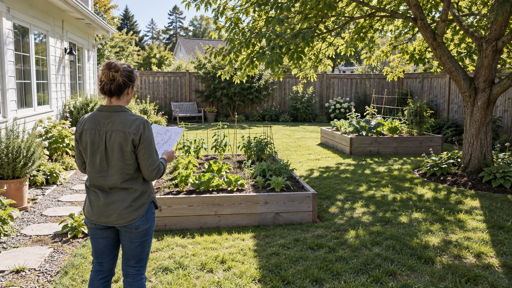
1. Decide what you are measuring
For garden planning, the most useful quantity is usually direct sunlight at a specific outdoor point: the period when the sun is above the horizon and an unobstructed ray can reach that point. It is different from daylight, general brightness, weather-station sunshine duration, lux and the light available below a translucent tree canopy.
Choose the centre of a proposed bed, a pot position or a seat as your first observation point. A street address or the centre of the yard is too vague when a fence or tree shadow crosses the area. For a long bed, repeat the method at both ends and in the centre.
2. Make an hourly garden sun chart
Pick a mostly clear day. Begin when the garden first becomes visible in daylight and check the selected point every 30 to 60 minutes until sunset. At each check, write down the local time and mark direct sun, shade or uncertain filtered light. A timestamped photo aimed at the ground can make the record easier to review without looking toward the sun.
Add only the intervals marked direct sun. An hourly check gives an approximate total; a shadow can arrive between checks, so shorter intervals improve the estimate near buildings and trees. University extension guides recommend observing the yard over time and making a simple sun chart rather than judging exposure from a single midday visit.
- Use the same marked point at every check.
- Record the source of shade: house, fence, tree or distant object.
- Repeat on several clear days if conditions are mixed.
- Repeat in another part of the growing season because the sun path changes through the year.
3. Interpret the total carefully
“Full sun” is commonly used for six or more hours of direct sun per day, while extension guidance divides part-sun and shade into lower bands. Treat those labels as broad planting language, not as a universal pass-or-fail rule. Species, climate, heat, soil moisture and the timing of the sun also matter. Check the guidance for the plants you intend to grow.
Keep the actual intervals as well as the total. Six hours from early morning to midday can produce a different garden condition from six hours of hot afternoon sun. Filtered light through leaves should be noted separately instead of counted automatically as full direct sun.
4. Estimate sunlight with a shadow model
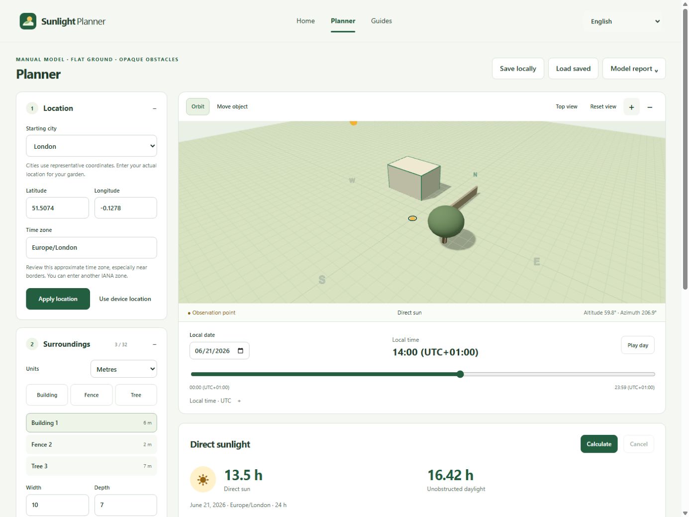
Open Sunlight Planner and enter the garden’s actual latitude, longitude and IANA time zone. Set the date, confirm geographic north, and add the nearest building, solid fence and tree crown with measured or defensible dimensions. Place the observation point on the ground where you made the sun chart, then calculate the day.
The planner checks the sun and your simplified obstacles in 5-minute samples. Gold intervals indicate modelled direct sun, green-gray intervals indicate shade and gray intervals indicate night. Move the time slider to investigate a disagreement, then correct the input that explains it. The model does not automatically find your house, neighbouring buildings or trees.
5. Work through one repeatable example
The built-in London example uses coordinates 51.5074, -0.1278, the Europe/London time zone, one flat-roof building, one solid fence, one opaque tree crown and a ground point at east 0 m, south 3 m. With those exact synthetic inputs, the 5-minute calculation gives 13 hours 30 minutes of direct sun on June 21, 2026, and 7 hours 35 minutes on December 21, 2026.
Those numbers describe the example geometry under a clear sky. They are not measured London sunshine and do not describe a real property. The useful part of the example is the method: keep the point and obstacles fixed, change one date, and record the result with its assumptions.
6. Check the model against the garden
Open the same date and local time as one of your field observations. If the model says direct sun while the point was clearly shaded, inspect geographic north, the time zone, obstacle height, distance and missing objects. If the day was cloudy, the observation cannot confirm whether the geometry was right.
A good model does not need decorative detail. A simple block with a measured height and position is more useful than a realistic-looking object based on guesses. Save uncertain dimensions and test a plausible high and low value to see whether your conclusion changes.
7. Know when this method is not enough
This workflow estimates clear-sky geometric direct sunlight on level ground. It does not calculate clouds, diffuse light, sloping terrain, leaf transmission, indoor illumination, solar-panel energy, legal right-to-light or building-code compliance. The tree crown is treated as an opaque solid, so compare the result with outdoor observations whenever foliage matters.
Use the result to compare garden locations and decide what to observe next. For costly construction, a boundary dispute, photovoltaic design or a formal daylight assessment, use verified site data and the relevant professional method.
A few things to know
How often should I check sunlight in my garden?
Every 30 to 60 minutes is practical for a first sun chart. Check more often when a moving shadow edge is important, and repeat the observation in another season.
Can I measure the whole garden from one spot?
No. Direct sun can change sharply across a shadow boundary. Check the centre and corners of each area that matters.
Does a phone light meter measure hours of direct sun?
A light sensor reports intensity at an instant. Measuring daily direct-sun hours still requires logging readings over time or using a geometric model with known obstacles.
Can a calculator replace outdoor observation?
It can compare dates and test assumptions, but missing or inaccurate buildings, trees, terrain and orientation will change the result. Use field observations to correct the model.